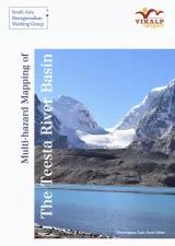
Multi Hazard Mapping of Teesta River Basin
The Teesta River is a prominent tributary of the Brahmaputra River. Teesta River basin covers an area of 11,888 km2 spread in India and Bangladesh. Due to high rainfall and earthquake-induced landslides, and forest fires; the sediment yield from the basin is highest in the Indian Himalayan region. Multiple ethnic groups have inhabited different parts of the basin area; thus, exposing them to different degree of challenges emanating from the events mentioned above.
The Proposed study will utilize recent land use and land cover data (Sentinel 2), forest fire point data from the Forest Survey of India (FSI), National Aeronautics and Space Administration (NASA) landslide inventory, and landslides demarcated from high resolution and multi-date Google Earth images to specify different types of eco-regions in the Teesta basin. This study will also provide recent changes in channel configuration and submergence of arable land due to hydroelectricity dam by comparing the pre-and post-dam construction scenarios using high resolution Google Earth images and other ancillary data.
The final report will be uploaded here soon.
