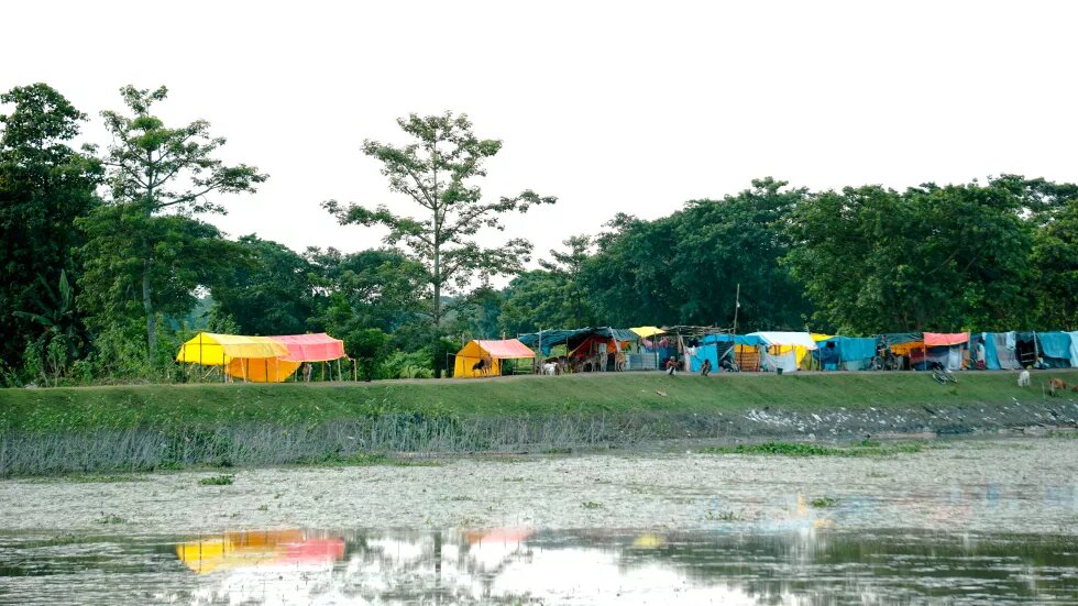
The state in Northeast India becomes more fragile than ever with extreme events like pre-monsoon floods and rain deficit.
Like every year in April before the onset of the monsoons, India Meteorological Department (IMD), India’s official weather forecasting agency, prepared the long period average (LPA) for the year 2022 and predicted ‘normal’ to ‘deficient’ rainfall across India. The prediction relayed that Northeast India would experience a ‘deficient’ monsoon while the rest of the country will receive about 96 per cent to 104 per cent of the LPA.
Businesses and markets rely on these forecasts and so do the farmers, the backbone of the Indian economy, across the country. A ‘normal’ forecast improves the rural demand, boosts income from farming while a rainfall deficit or even an excess, on the other hand, may lead to an inflated prices for food and other essential commodities.
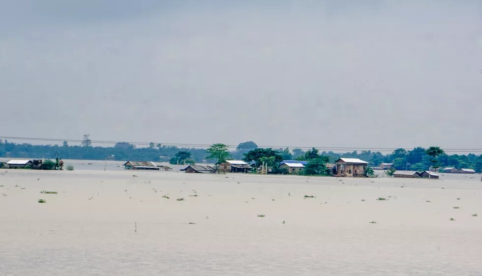
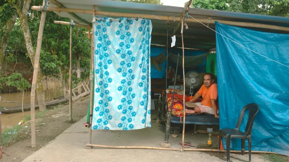
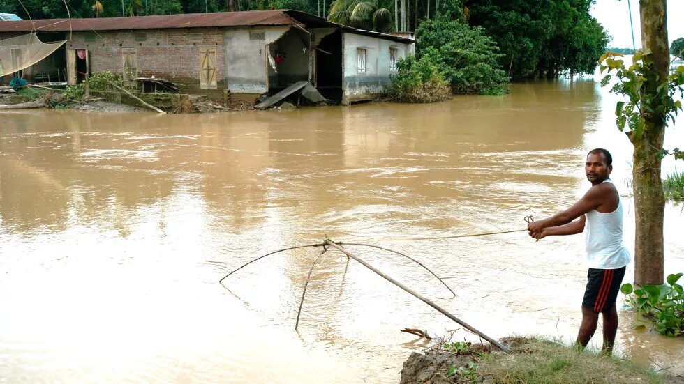
By August, however, the monsoon in Northeast India was far from normal. In a span of three months starting from May, Assam, Meghalaya and Arunachal Pradesh witnessed two waves of devastating floods followed by drought-like conditions in July and August. Both floods and deficient rainfall broke century-old records. Even before the arrival of the annual monsoon this year, which brings about 80 percent rains to India, Assam was flooded by pre-monsoon rains. From March to May, Assam witnessed an excess of 40 per cent of rainfall. The flood waters of May were just receding when monsoon arrived and by June 20, 32 districts were inundated in which thousands of houses were washed away displacing close to 4.8 million people and damaging 1,99,438 hectares of cropland – including people who were displaced twice within 15 days struggling with two waves of floods. The floods and landslides have killed 197 people, wiped out more than 100 kilometres of railway tracks, including the arterial national highways, hundreds of embankments and other flood protection architecture.
The food security of the entire region has been destabilised due to these excessive rains, quickly followed by a drought-like condition in a matter of months. A study conducted in 2021 ranked Assam as one of the most vulnerable states in India to the impact of global climate change. The study stated that since 2010, 20 districts in Assam had been witnessing exponential increase in the frequency of extreme climatic events.
At its peak, this year’s floods displaced close to 5.6 million people on a single day, according to the Assam State Disaster Management Agency (ASDMA). Almost the entire city of Silchar situated in South Assam remained flooded for close to three months while hilly districts such as Dima Hasao, where floods are rare, saw widespread devastation in quick succession in May and then again in June this year.
Several experts and organisations including the IMD have termed the June 2022 disaster due to excessive rainfall over a short period as an impact of global climate change. In Assam, the effect of climate change has been felt even more due to massive infrastructural failure. The Assam government has termed both the waves of floods in May and June as a human-induced disaster characterised by the failure of flood protection measures such as embankments and sudden release of waters from hydroelectric dams. To add to the misery, the central government’s push for more connectivity with rest of India as well as Southeast Asia by building linear infrastructure such as roads have also taken a huge toll.
Levelling the hills
After years of armed conflict and insurgency, the Assam government started promoting Dima Hasao, an autonomous hill district within Assam, as a tourist destination in 2015. Surrounded by the Barail mountain range that runs from Assam to Manipur, Haflong, the district headquarters of Dima Hasao, was serviced by a metre gauge line commissioned in 1904. The colonial British government built the line, considered as one of the most spectacular mountain railway tracks in India, to connect Silchar to transport tea, timber and coal from Assam to the ports in Bangladesh.
In 2008, Northeast Frontier Railways (NFR), a division of Indian Railways, started gauge conversion for the 237-km-long line between Lumding and Badarpur in southern Assam. According to ‘Vision-2020’ prepared by the North Eastern Council, a nodal agency for the economic and social development of the region, the NFR was supposed to connect all the state capitals of the Northeastern states by 2020.
The gauge conversion was completed in the Dima Hasao section in March 2015. A news report stated that the railway gauge conversion faced several geological and technical difficulties while making 21 tunnels by cutting hill slopes.
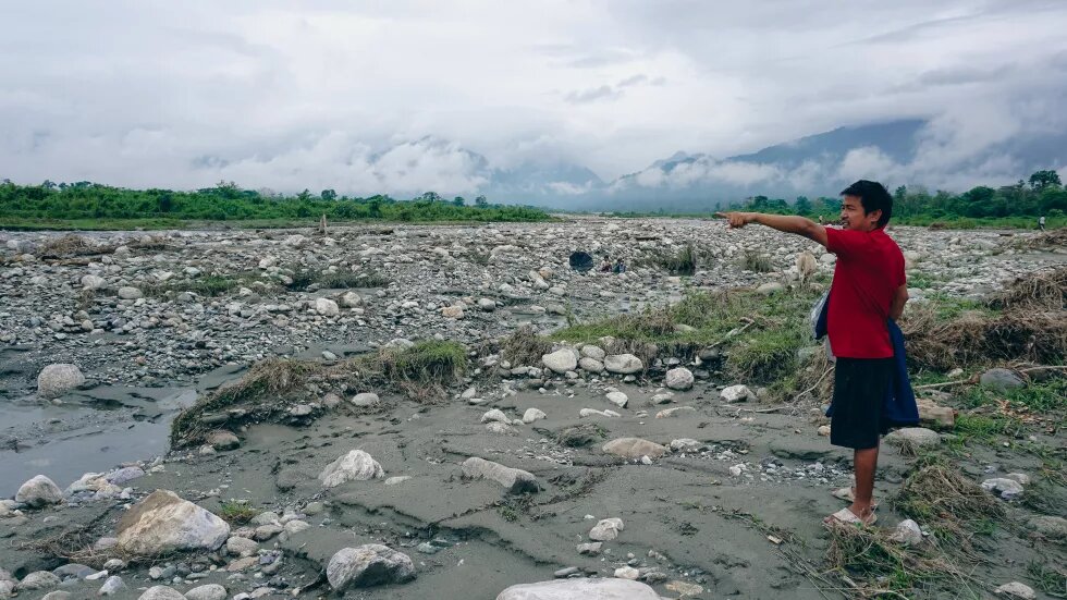
In November 2015, Indian railways began operating passenger trains through the route. The situation changed quickly in May 2022 during the pre-monsoon showers when the district received 451 mm of rainfall compared to 200 mm rainfall it usually receives in the month. Two smaller rivers, Jatinga and Mahur, flooded several villages, destroying over 2,000 houses and more than 2,500 hectares of agricultural land. Although landslides are common on the railway tracks even when metre gauge trains were operating between Lumding and Silchar, the May rains took an unprecedented toll on the tracks.
A petition filed before the Gauhati High Court by All Barak Youth Students’ Association (ABYSA), an organisation that challenged NFR’s gauge conversion activities citing massive irregularities, stated that 2,200 passengers from two trains from Silchar were stranded surrounded by the landslides in Dima Hasao on May 15. Many of these passengers were airlifted by Indian Air Force helicopters to Silchar while several others walked to safer areas. On May 14 night, surface runoff and landslides from the hills destroyed trains parked in the New Haflong railway station, which was filled up with debris. Locals say that the runoff emerged from the hills, parts of which were levelled to construct the railway station after the gauge conversion. The district incurred a loss of about Rs.400 crore due to the floods and landslides.
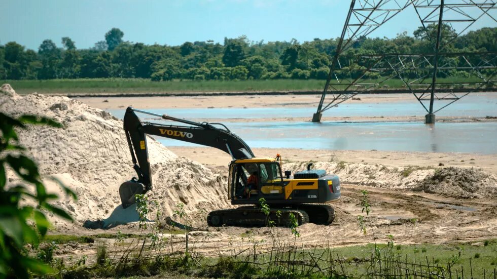
Experts consider the rampant river mining at Jatinga village and Mahur town for construction material as a factor that exacerbated the impact of floods. The hill district is rich in minerals and has witnessed large scale boulder mining near the towns of Harangjao and Haflong. The resources extracted are being exported through the same railway network.
Open the floodgates
The May 2022 floods also devastated large cropping areas by dumping muck and debris in the fields from the hill districts. Over the years, Assam developed a few hydroelectric projects in these districts assuming that the large water storages would control floods. The weather gods had other plans.
Even as heavy rains lashed the state in May-June, Nagaon, a district situated in the downstream of the hill districts of West Karbi Anglong and Dima Hasao, remained rain deficient. Kopili, a sub-tributary of the Brahmaputra, has at least two hydroelectric dam projects situated in Dima Hasao, that borders Karbi Anglong.
The water from the floods of May nearly stayed for a week in these parts. As people started returning from the relief camps, monsoon entered Assam by the second week of June. By June 17, the Kopili along with even smaller rivers like the Nonoi in Berhampur or the Killing in Nellie caused havoc. The reservoirs at the two river projects – Kopili 1 and Karbi Langpi – released their waters due to heavy rainfall.
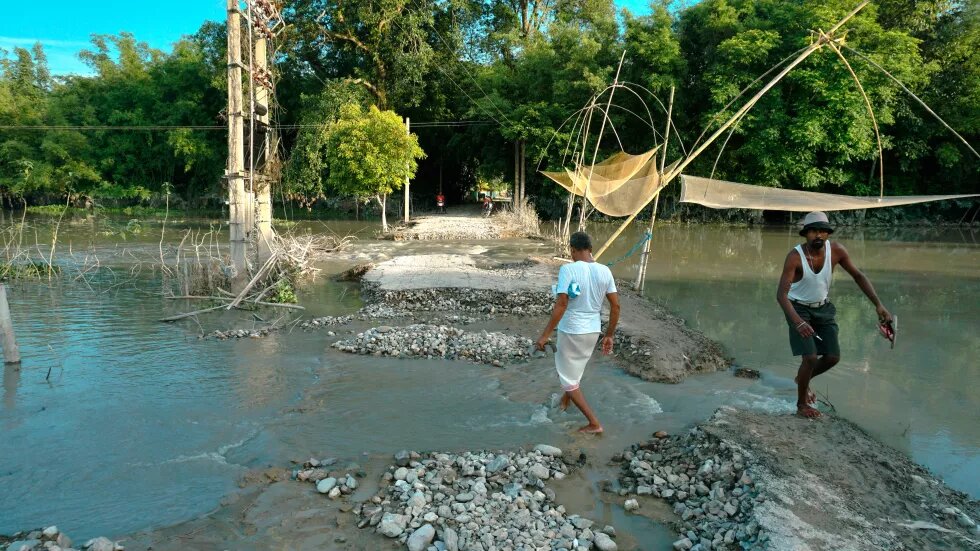
The residents living downstream of these dams were not prepared for another deluge. Jiten Nath, a school teacher from Ghagarial village under Berhampur circle in Nagaon estimated that it generally takes three days for the dam waters to reach his village downstream. “The rains in June, however, caught us off guard as the Kopili’s waters gushed inside our homestead overnight. Even a small stream called Borpani wiped out two bridges and a road connecting us directly to the district headquarters in Nagaon,” said Nath.
The Kopili hydroelectric project in Dima Hasao district has two concrete gravity barriers, which have been mired with controversy. Between 2019 and 2022, eight employees were killed due to pipeline bursts in the dam sites. North Eastern Electric Power Corporation Limited (NEEPCO), a central public sector company, now has plans for a second Kopili project with funding from the Asian Development Bank.
A senior Nagaon district administration official blamed the floods on the water released from the dam and heavy rainfall. “It rained heavily everywhere. The heavy flooding is due to the dam release but there is also excess water from the rains,” the official said.
In Nellie, residents sought shelter on the national highway; later some people also ventured inside jungles on hilly slopes braving encounters with wild animals. A resident, Sunil Mallick, said: “The flood waters are from the Kopili and Killing rivers. The TV news said that dam authorities would open all the gates on the Kopili. However, we suspect that even Meghalaya dams such as Umiam also released their water onto the Killing.”
Similarly, flood affected people in the north bank of the Brahmaputra, especially in districts such as Barpeta, Nalbari and Darrang that share the borders with Bhutan, have blamed the floods on dam release from Bhutan. South Asia Network on Dams, Rivers and People (SANDRP), an informal network working on issues related to rivers, stated that the dam-induced floods from Bhutan had been observed since 2004, when a large landslide lake formed in the upstream of Kurichu Dam, situated close to Indian border, broke inundating several villages downstream. A new committee was formed in Bajali district on July 6 to raise the concerns about the downstream impacts of these dams on Assam on national and international platforms.
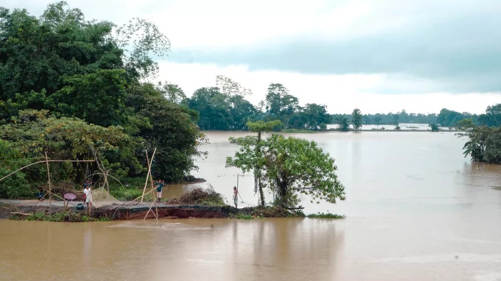
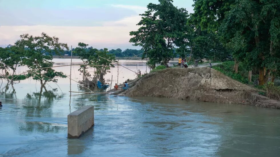
In Assam, dykes or embankments and smaller check dams have been disastrous too. This year, close to 330 embankments have been breached by floods. Assam has a total of 423 embankments covering 4,474.42 km. Out of these, 295 embankments have outlived their lifespan.
In Darrang district, two small rivers, Saktola and Nonoi, submerged close to 150 villages. In Mangaldoi, Darrang’s headquarters, the Saktola river deviated from its course, breached an embankment twice – once in May and then again in June. As a result, 70 per cent of the Saktola river flowed through the breached embankment, submerging more than 30 villages twice and displacing close to 50,000 people. In June, the Saktola river damaged a large portion of the National Highway 15 between Sipajhar and Mangaldoi, stalling food and relief supplies for a week.
The Saktola river has an interesting history. Till 1996, the river, also known as Kulsi in the upstream district of Udalguri, used to be an irrigation channel, according to Deepak Sarma, president of a farmers’ group in Udalguri. “The Nonoi and Bholla are two rivers that emerge from Bhutan. People diverted a portion of these rivers to the Saktola for irrigation near the Bhutan border. In 1996, after heavy rainfall, the Nonoi started flowing into the Saktola that devastated the Darrang district,” said Sarma.
Later that year, Assam’s Water Resources Department built a barrage to separate the Saktola from the Nonoi. For more than two decades, this arrangement worked for the people living downstream. Farmers also formed ‘baandh committees’ (dam committees) for river protection works in the area. According to Sarma, there are 22 such committees in the area that protect the river banks by building walls with stones and wire meshes. “In 2018, flood waters from Bhutan washed away the barrage causing the Nonoi and Saktola to merge again. Around 300 bigha (187.8 acres) of land have been eroded since 2018. Further, illegal riverbed mining downstream has also contributed to these floods,” added Sarma.
The Saktola carried dark muddy sediments, which were visible along the entire course of the river from the Bhutan border till Mangaldoi. When floods did not recede for close to seven days in June, villagers near Mangaldoi breached the same embankment on their own in the downstream that had swamped the farmland. “The people informed the administration before taking the step. After we breached this embankment, the water flowed back to the existing course of the Saktola and then to Brahmaputra,” said Jyoti Prasad Baruah, a contractor with the Public Works Department from the village.
Flooded cities
Southern Assam faced a similar predicament this year. The Barak is a major river in southern Assam that flows into Bangladesh after emerging from the hilly terrains of Manipur and Nagaland. It is connected by a network of several small tributaries spread across hill districts of Assam, Meghalaya, Mizoram, Manipur and Nagaland. Through a network of embankments, the Assam government over the years took flood protection measures. According to Assam State Disaster Management Agency (ASDMA), Cachar district with Silchar as the headquarters, recorded 43 breaches of embankment this year, which was highest in the state.
Out of 28 municipal wards of Silchar, an economic hub for southern Assam, 27 are flood prone, according to a flood vulnerability mapping exercise conducted by ASDMA in 2014. After the floods in the 1980s, the Cachar district administration constructed embankments along Silchar’s periphery. With pre-monsoon rains hitting the adjacent hilly terrains in mid-May, two breaches were reported. The first breach, upstream of Silchar, filled up water bodies that quickly flooded a portion of Silchar and surrounding villages on May 19. As the waters remained stagnant, on May 23, some alleged miscreants from Bethukandi, a neighbouring village, cut open a portion of an embankment downstream. The second breach was considered as a sabotage after which the Water Resources Department was tasked with repairing both the breaches. Reports indicate that the local administration managed to seal only the first breach.
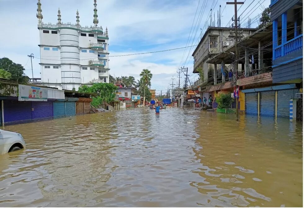
Between June 1 and June 27, according to IMD, Cachar district witnessed 88 per cent excess rains with the Barak river reaching its highest flood level since 1989. By June 19, waters from the Barak at its peak gushed inside Silchar. On June 20, the city was completely flooded with entire floors of houses submerged in some areas. A preliminary assessment from July shows that 25,571 houses were damaged in Silchar.
While preparing Silchar’s hazard profile in 2014, ASDMA concluded drainage congestion as one of the main reasons behind the flooding. Local experts also point towards the shrinking of the water bodies around the city and creeping urbanisation as factors exacerbating floods. A study of the Barak by Wildlife Institute of India stated that between 1988 and 2018, the water bodies decreased by 23.48 per cent while the urban area increased by 73.76 per cent in the Cachar district.
Assam’s other urban centres are no different. Water logging is an annual affair in certain parts of Guwahati, which were reclaimed from water bodies and low-lying pastoral lands. Considered as the gateway to Northeast India, Guwahati is witnessing an unprecedented expansion of built-up area characterised by flyovers, highways, malls and apartments – a trend which is now being mimicked by smaller towns across Northeast India. Even as the city lacks proper drainage and waste treatment, the Assam government plans to expand the radius of the city by 66 square kilometres.
Thus far, the monsoon this year has been far from normal. While large excess in pre-monsoon rainfall caused havoc and untold miseries to millions in both the Brahmaputra and Barak valleys, a record dry July stands as an impediment to paddy sowing. As many still continue to be displaced without access to proper sanitation and medical facilities, Assam is looking at a bleak future riddled with probable impacts on food security.
With excessive rains before the onset of the annual monsoon, Assam floods of 2022 have proven yet again that this region of Northeast India is really vulnerable to the impacts of global climate change. Exacerbating these catastrophic impacts of global climate is the haphazard, rushed and unplanned developmental design of the region, which is contributing to the expansion of the areas facing the hazards. Be it unplanned railway and road construction or dam building or even leasing out land for mining the rivers, both central and the state governments seem to be obsessed with making short term populist measures masquerading as a developmental agenda for the state. Worse, on the ground, projects are being commissioned without proper data or surveys or any public consultation to further this developmental agenda. As a result, one instance of an extreme event can easily wipe out vast expanses of croplands, drown cities and jeopardise food security of a million people in a matter of days. In the next part, we aim to examine and analyse the historical and geological factors behind the massive losses caused by the repeated occurrence of floods in Assam.
This is first part of the two-part series on Assam floods, 2022.
