Large infrastructure pushes for connectivity, power generation and even flood protection may worsen the situation and exacerbate impacts of climate change.
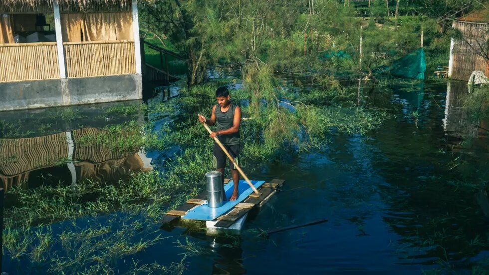
Compared to the rest of the country, Northeast India is just five per cent of the country’s area but has thirty per cent of the national water resource potential. Across the region, water availability normally goes up once around spring with pre-monsoon rains along with the snow melting in the Himalayan region and again, with southwest monsoons in June. Farmers across the state eagerly wait for the pre-monsoon showers to sow the summer paddy or boro rice from April onwards. As the stormy April brings the first showers along with thunderstorms, farming communities turn the soil and get their paddy nurseries ready for sowing.
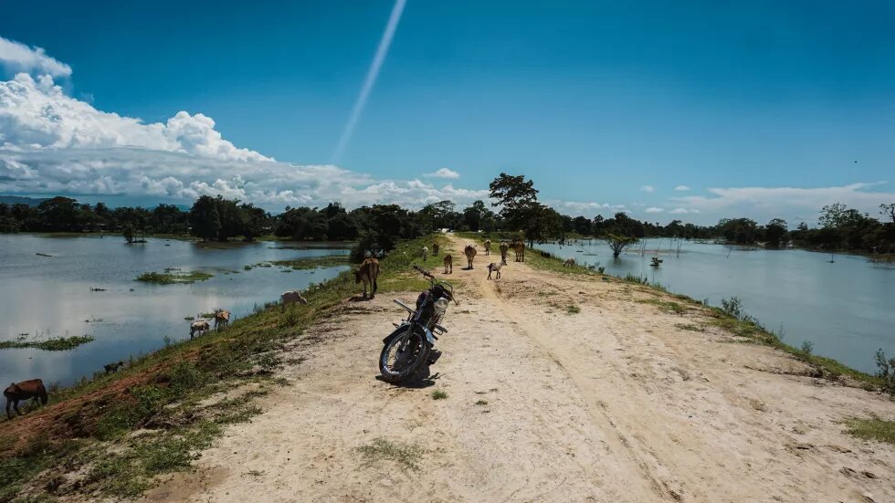
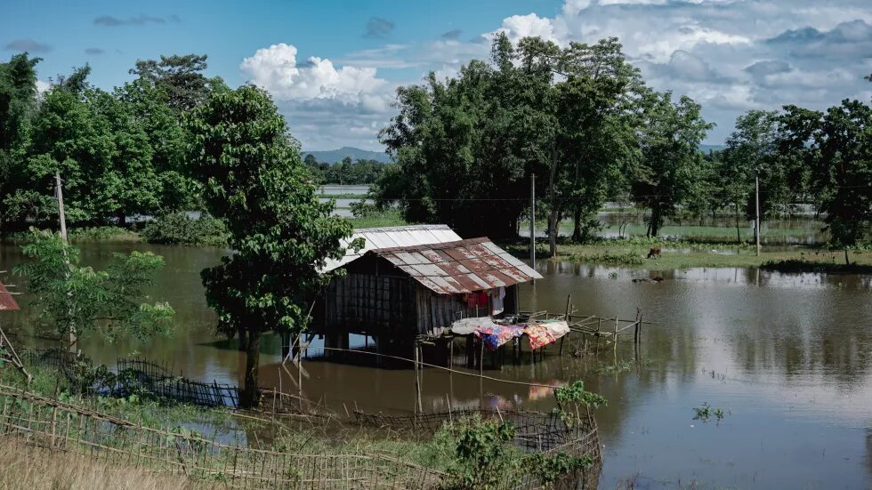
With thousands of hectares of cropland submerged during the two waves of floods in 2022 that decimated most of the standing crop, farmers were gearing up for sowing activities as the floodwaters started receding in July. The woes, however, persist. Following the deluge in May and June, several districts in Assam are experiencing drought-like conditions.
A study by Pune based Indian Institute of Tropical Meteorology, a government institution that has been studying growth of teak trees across India, revealed that Assam had been witnessing a decreasing trend in the monsoon rainfall since the 1870s while experiencing sudden downpour days leading to frequent flooding.
States in the Northeastern part of the country, according to the IMD data, recorded deficient rainfall for July 2022; in fact, it was the driest July for Assam, Nagaland and Arunachal Pradesh in 122 years.
A report by the Union Agriculture Ministry has noted a 13 per cent dip in total area under paddy coverage for the month of July. Besides major rice producing states in the country, Northeastern Indian states including Assam, Mizoram, Meghalaya and Tripura, where rice is a staple diet, also reported less sowing for the months of June and July.
Unnatural disaster
Pre-monsoon floods are not uncommon in Assam. Even in 2020, as Cyclone Amphan hit West Bengal, Assam reeled under flash floods. A study on the impact of climate change over the Brahmaputra basin by Indian Institute of Technology, Guwahati states that the number of flood waves per year has increased from 1–2 flood waves to 2–3 flood waves per year for the pre-monsoonal period.
In 2022, the south-west monsoon arrived two days earlier, according to IMD. The monsoonal trough that oscillates in the east-west direction at a lesser altitude brought in copious amounts of moisture from the Bay of Bengal. The moisture travelled towards the foothills of Eastern Himalayas bringing a mega flood in June 2022. These conditions created by the advancing monsoon led to record breaking rainfall in Northeast India with Assam and Meghalaya experiencing the highest June rainfall in 121 years.
Despite large excess in pre-monsoon and early monsoon rainfall in Assam, two of the most affected districts in the south bank of Brahmaputra, Nagaon and Morigaon, below the catchment area of river Kopili, remained rain deficient. As rains started lashing the two hill districts of Dima Hasao and Karbi Anglong and in Meghalaya, hydroelectric projects in this region operated by the North Eastern Electric Power Corporation Limited (NEEPCO), a government owned body, released excess water from their reservoirs into Kopili. In a span of days, hundreds of villages under the two districts were marooned even before the arrival of monsoon in Assam.
Dam induced floods have been a regular feature in rivers like the Kopili, Ranganadi and Doyang, which have dams operated by NEEPCO. The Ranganadi hydroelectric project situated in Yazali in Arunachal Pradesh, an Indian state that shares a border with China, is notorious among the locals living downstream for releasing water without warning. The Doyang multipurpose project in Wokha district of Nagaland, on the other hand, has flooded parts of Golaghat district in Assam on numerous occasions, even when the region was facing a drought-like scenario in 2018.
Flood victims in the north bank of Brahmaputra also put the blame on electricity generating dams built upstream in Bhutan. Many are of the opinion that the district authorities as well as its Bhutanese counterpart were careless enough to not notify the people living downstream about the sudden release of water that filled almost every river flowing down from Bhutan to the brim, which caused large scale destruction.
In a bid to export electricity, the Government of Bhutan has decided to develop more hydroelectric projects in the long run with the help of the Government of India. There is a plan to increase the power generation from the present 2,000 MW to 12,000 MW with two new projects coming up in the country. After deluge in lower Assam this year, the state ministers took up the issue of dam release with the Bhutanese government, however with no consensus in sight.
Contrary to the central government’s claims that dams also provide cushion for floods, experts such as Dr. Nayan Sarma, who served under Assam’s Irrigation and Flood Control Department and also taught river engineering in Indian Institute of Technology, Roorkee, said that none of the existing dams in Northeast India and Bhutan have any flood control capacity. In a video interview with a Bengaluru based news outlet on 28 June 2022, Sarma said: “Whenever there is a big downpour in the catchment area, all these dams release the excess flow, as they do not have any flood storage capacity.”
Curiously, the Union government has been majorly pushing hydroelectric dams across Northeast India for over three decades. Among the big dams, Lower Subansiri Hydroelectric Project, which was opposed by several organisations in Assam for over two decades, is supposed to be commissioned by the end of 2022. In June, however, workers had to be evacuated as in the previous monsoons with landslides collapsing the guard walls of the dams on several occasions. The central government has also proposed mega dams in Siang River, the main channel of Brahmaputra, while in Arunachal’s Dibang valley it plans to build India’s largest dam. The Arunachal Pradesh government in the last two decades signed close to 200 agreements with dam developers citing a large hydroelectric power generation potential even as no cumulative impact assessment or consultation with the affected communities downstream of these proposed dams were carried out by the government. Recently, the Union government stated that China has already built several dams on the Brahmaputra river. It justified that the dam over Siang in Arunachal Pradesh would counteract with the impacts of Chinese dams across the border.
In the run up to Assam elections, Sarbananda Sonowal, the former Assam chief minister who is now the Union Minister for Shipping, prioritised dredging of the Brahmaputra as a measure to solve the recurrent flood problem. The Brahmaputra, however, is a major silt carrying river in the world. On an average, the river carries 2.12 million tonnes of suspended sediments daily. Experts such as geologist Jogendra Nath Sharma, have questioned the viability of dredging a river like Brahmaputra with such a heavy sedimentary load. Further, as the river straddles inter-state and international boundaries, dredging the river at certain pockets in Assam is unlikely to have any long-term effects such as flood control as many reports indicate.
Tectonic shift
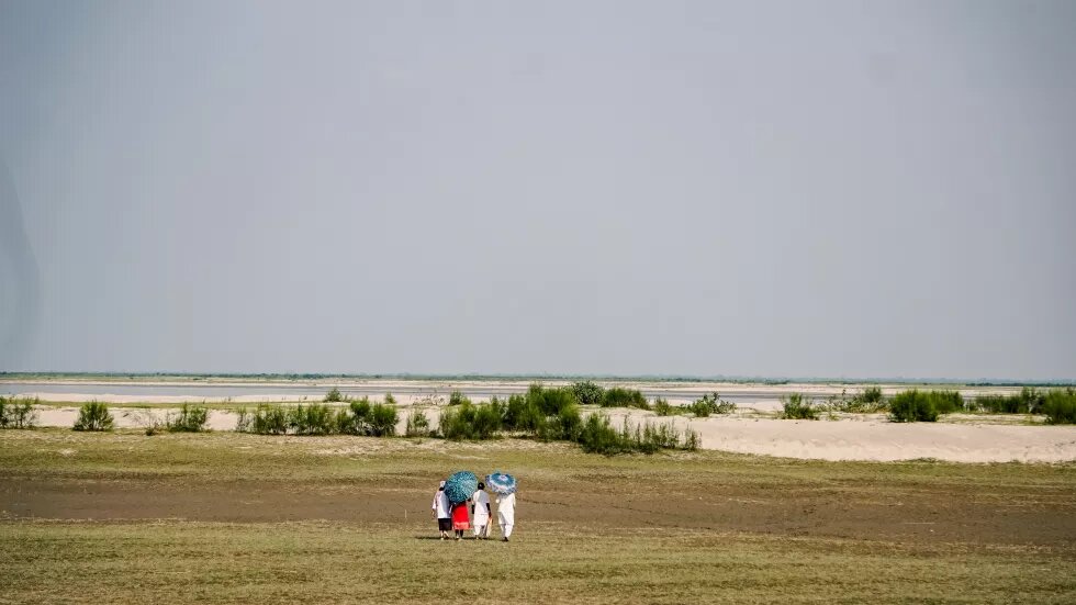
While floods bring misery, they foster an exchange of nutrients by flushing out the debris from the wetland ecosystem rejuvenating the entire biome of the state. Bijoy Krishna Chetia, a geologist from Upper Assam who has been studying river morphology, remarked that without floods, Assam would become a desert. However, the expansion of flooded areas is already contributing to the desertification in the state. When the flood waters recede, all that is left is a desert, as many reports would indicate. A study by the Indian Space Research Organisation (ISRO) in 2016 estimated close to 45 per cent of Assam’s land has degraded due to the expansion of the waterlogged areas. All the states of Northeast India including Assam top the list of Indian states becoming increasingly degraded and arid.
The impact of the floods has been pronounced in the last 70 years, especially over the Brahmaputra valley as the region witnessed recent tectonic changes. After the 1950 Assam earthquake, the Brahmaputra riverbed was raised by several metres. Add to this, the massive amounts of silt and debris being brought down from the Himalayas by the Brahmaputra system. Geologist Dulal Goswami and ecologist Partha J. Das observed in their research titled “Hydrological Impact of Earthquakes on The Brahmaputra River Regime, Assam: A Study in Exploring Some Evidences” that before the 1950 earthquake, the Brahmaputra rarely used to cross the danger level. “But since 1954, the river rises above the danger level more than once every year and remains above the danger level for 15 to 20 days or more,” they stated.
One of the most important characteristics of floods in the Brahmaputra as observed this year is the extreme floods caused by its tributaries. The research by IIT Guwahati had already warned about this phenomenon, which had been exacerbated due to extreme rainfall in the catchment area of these tributaries. With the tributaries flowing at above danger marks, the raised Brahmaputra river can push the water back, aggravating the floods. “Such things happened in the past too, when a tributary as well as the main trunk river [Brahmaputra] flows with unusually high discharge. This is possibly a post 1950 phenomena when the Brahmaputra became shallow because of unusually high sediment discharge for several years which may impact south bank tributaries especially,” said Sarat Phukan, a geology professor in Gauhati University.
Seismic activity, especially in faults like Kopili where a 6.4 magnitude earthquake was felt in 2021 shaking up the entire Eastern Himalayan region, may have tilted the earth’s surface by a few degrees in Sonitpur district, the epicentre. “The studies are ongoing but unusual flooding also has to be related to the seismic activity especially in faults like Kopili that criss-crosses Brahmaputra valley. We believe that neo-tectonic activity along the fault might have also contributed to the floods,” Phukan added.
Geologists maintain that the rampant exploitation of natural resources like mining as well as unscientific construction of railway tracks will have long term impacts, which may be responsible for the devastation that happened in Dima Hasao. Phukan had studied the Barail range where most landslides occurred that devastated a railway line. The range is a result of a tectonic collision characterised by thrusts. The Barail range, according to Phukan and several other geologists, is a part of the Disang thrust. The hills and valleys of Northeast India, which have formed in the recent geological past after two continental plates Eurasia and Gondwana collided about 50 million years ago are characterised by such thrusts. Phukan observed that the central government’s new railway construction has taken place along this thrust, which is highly prone to landslides. “These areas have Disang shale rocks, which are highly unpredictable especially during monsoon and can easily disintegrate under pressure. The situation has been further exacerbated by the heavy rains, in the form of landslides and a large surface runoff that has flooded the areas,” Phukan said.
Nowhere to go
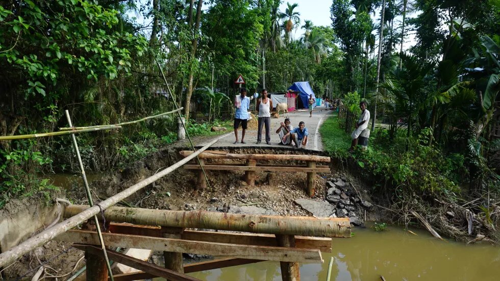
This year’s floods have been the most devastating one in recent memory. While elders tried to relate the devastation wrought with the great deluge of 1988, for many young people, this was the single largest phenomenon. The government claims to have undertaken the task of repairing embankments that breached during the floods this year.
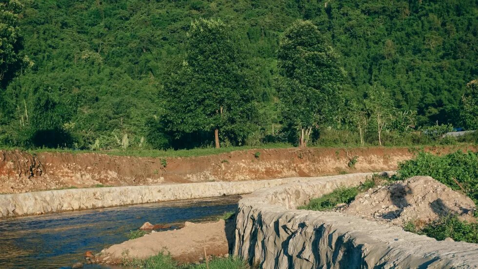
Flood control measures in India such as dykes and embankments have their history rooted in colonial river engineering that sought to safeguard its mercantile economy. After Independence, these exercises were undertaken with a view to binding India together through infrastructure development, which, along with river infrastructures such as embankments, have become popular election rhetoric in Assam.
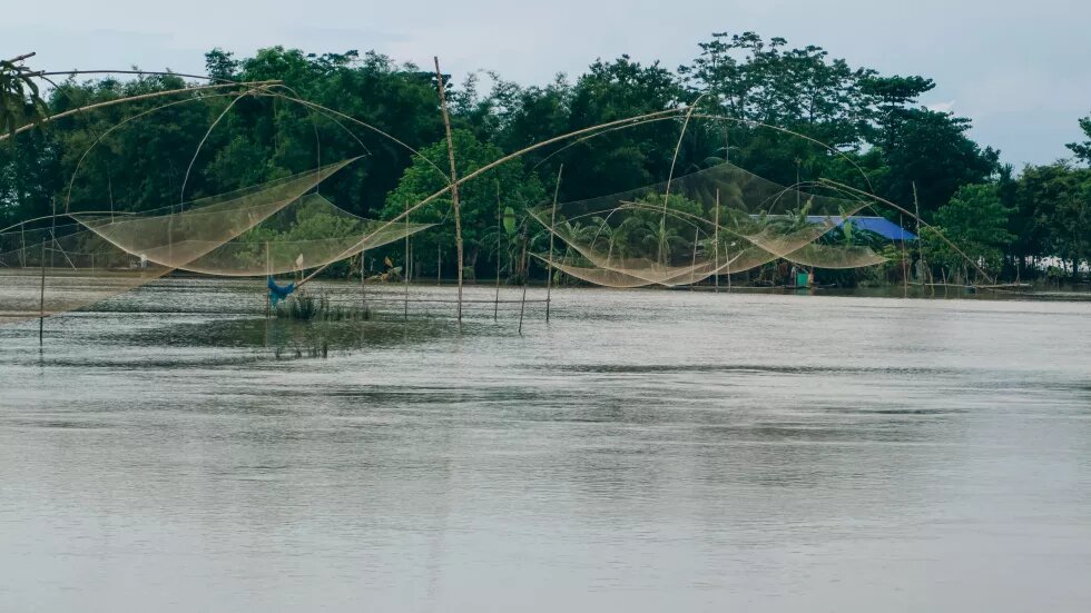
Floods were not always seen as a problem that needs to be fixed by various communities living in Assam. Over the years, communities have adapted to the floods with their housing, depend on the fresh silt for flood resistant agriculture and use the flood waters for fishing. Increasingly, however, design policies aimed at flood control have jeopardised this adaptation. Kaziranga, a World Heritage Site and a known conservation space for one-horned rhinoceros, has been turned into a fortress to protect the park from poachers and floods. The area is populated by the Mising tribe who live on houses built on stilts to keep away from the floods. With a massive grant from Asian Development Bank, the park authorities have been building a massive embankment that has disturbed the water regime of the region, according to the locals. The embankment is regulated by a series of sluice gates that control the flow of runoff from the nearby hills to prevent the flooding of the park. For the Mising farmers, however, the water from the runoff now stays in their homesteads for days causing agricultural losses.
As rivers continue to change direction flooding entire villages or urban centres for days hindered by embankments that restrict its natural flow, flood protection measures have become somewhat of an oxymoron.“Embankments are both a symbol of safety and a source of sorrow. Embankments have protected people physically from floods and provided safe shelter for them during floods. Yet, it is because of the failure of the same embankments that floods have become destructive,” stated Partha Das in his paper.
In another scenario, these artificial barriers have dissected floodplains into two zones, where one outside the embankment becomes inundated as soon as the rivers swell up and in instances of embankment breaches, floodwaters gush in to submerge the areas inside.
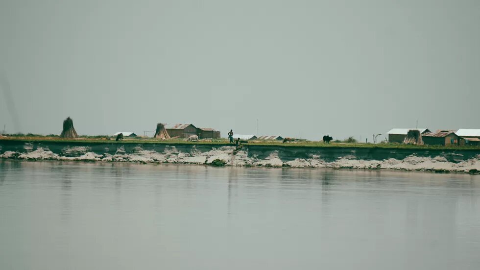
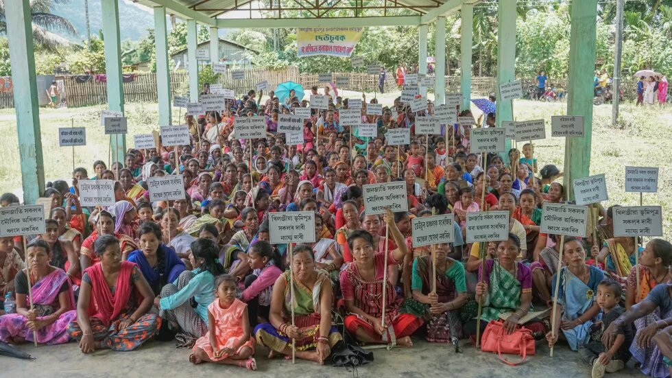
With large areas going under water, croplands decimated by rains, people from the rural areas migrate to Guwahati and other big cities in India in search of jobs. Communities move along the Brahmaputra river and other tributaries in search of higher ground. These often create historical misunderstandings with one community accusing the other as an encroacher. Of late, the Assam government has actively participated in this conflict by conducting citizenship tests against certain marginalised communities suspected as foreigners. In other places, several people mostly seeking refuge in reserve forests or pastoral lands for decades have been deemed as encroachers and evicted. Cities like Guwahati provide employment and some amount of anonymity from being identified as an encroacher, which makes them important destinations for most migrants from vulnerable areas facing floods and landslides.
While on paper, Assam and other Northeastern states have been considered as among the most vulnerable regions by the Union Ministry of Environment, Forest and Climate Change, there seems to be a disconnect between learning from the ground after every subsequent disaster and policy decisions. In Assam, people are witnessing what the Intergovernmental Panel for Climate Change (IPCC) in its report has predicted about the expansion of vulnerable areas with flooding becoming more and more frequent in the Brahmaputra valley due to excessive rainfall. Pushing large infrastructure in the name of connectivity or for power generation and flood protection might just be the immediate factors that will exacerbate the impacts of climate change. Unless the Government of India and Assam government make an assessment of such infrastructure over the region, the impact of the disasters will be more acute and felt by all sections of the society, and also businesses and markets, which depend and operate in the region.
References
Monsoon climate response in Indian teak (Tectona grandis L.f.) along a transect from coast to inland Authors: Saikat Sengupta, Hemant Borgaonkar, Reji Mariya Joy & Somaru Ram, Published: Theoretical and Applied Climatology volume 134, pages1197–1205 (2018)
Link: https://link.springer.com/article/10.1007/s00704-017-2334-z
Ministry of Environment, Forest & Climate Change (MoEF&CC), Government of India, New Delhi. Space Applications Centre (SAC), ISRO, 2016
Link: https://www.isro.gov.in/desertification-and-land-degradation-atlas-released
Hydrological Impact of Earthquakes on the Brahmaputra River Regime, Assam: A Study in Exploring some evidences. Authors: Dulal C. Goswami and Partha J. Das, Published: My Green Earth, 2008
Link: https://web.archive.org/web/20180329070330/http://brahmaputrariversymposium.org/wp-content/uploads/2017/09/Flood%20&%20Earthquake%20of%20Assam.pdf
Framing India’s Hydraulic Crisis: The Politics of the Modern Large Dam, Authors: Rohan D’Souza, Published by: Monthly Review, An Independent Socialist Magazine, 2008
Link: https://monthlyreview.org/2008/07/01/framing-indias-hydraulic-crisis-the-politics-of-the-modern-large-dam/
(Un)natural Disasters and the Role of the State in the Brahmaputra Valley, Assam, Authors: Mitul Baruah, Published by: Cambridge University Press 2017
Link: https://www.cambridge.org/core/books/abs/northeast-india/unnatural-disasters-and-the-role-of-the-state-in-the-brahmaputra-valley-assam/65539AD79F0F7A0A451954E5DEE8E51D
Hydrocracies, Hubris, Hazardscapes: Infrastructuring Floods in the Brahmaputra River Basin, Author: Mirza Zulfiqur Rahman, Published by Economic and Political Weekly, 2020
Link: https://www.epw.in/journal/2020/39/commentary/infrastructuring-floods-brahmaputra-river-basin.html
This is Second part of the two-part series on Assam floods, 2022.
